Location: Steni Evias
Date: 30/11/2025
Time: 10:00
Distance: 5,5km
Alt Gain/Loss: +249m | -249m
Stations: 2
Lowest point: 408m
Highest point: 607m
Registration Fee:
Basic Pack 10 €
Plus Pack 25 €
Benefits
| Paths of Katzos 5km | BASIC PACK | PLUS PACK |
|---|---|---|
| runner number | ||
| Digital timing with chip | ||
| Fuel stations | ||
| medal | ||
| Provision of water, sports drinks, soft drinks (at fuel stations) | ||
| first aid services and medical care | ||
| photos | ||
| Short sleece tshirt Αnthrax | ||
| Cost | 10 € | 25 € |
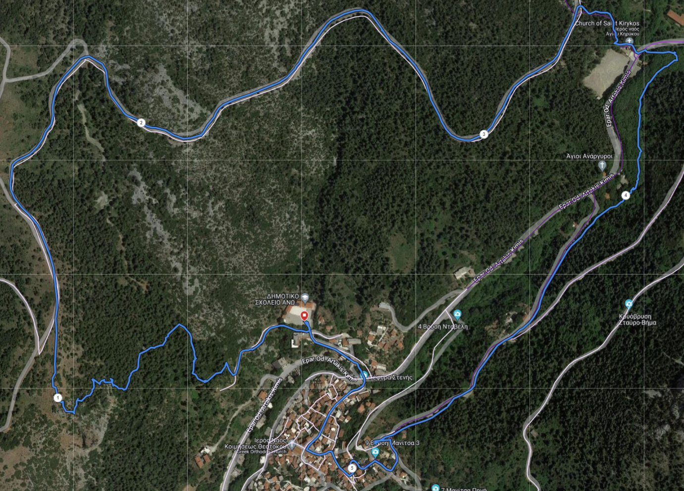
Route description
The race starts from the Stenis school at an altitude of 400 m. For 1 km, it has an uphill, technical path, with an altitude difference of 200 m. We reach the 1st feeding station (1.1 km) and continue on a dirt road for 2.5 km to the Stenis stadium, where we will pass the river to enter the sycamore forest of the village where the 2nd supply station is (3.6km). We continue on asphalt for a few meters inside the village until the finish at Stenis school.
Stations
FOOD
| POI | Description | Total Distance | Νερά | Coca Cola | Αλμυρά | Μπανάνα | Σοκολάτα |
|---|---|---|---|---|---|---|---|
| Start | Race start | 0,0 | |||||
| CP1 | T. Anastasiadis station | 1,1 | |||||
| CP2 | L. Karagianni station | 3,6 | |||||
| End | Race end | 5,5 |
STATISTICS
| POI | Description | Altitute | Total Distance | Total D+ | Total D- | Part. Distance | Part. D+ | Part. D- |
|---|---|---|---|---|---|---|---|---|
| Start | Race start | 431 | 0,0 | 0 | 0 | 0 | 0 | 0 |
| CP1 | T. Anastasiadis station | 602 | 1,1 | 171 | 3 | 1.1 | 171 | 3 |
| CP2 | L. Karagianni station | 487 | 3,6 | 212 | 156 | 2,4 | 41 | 153 |
| Stop | Race end | 431 | 5,5 | 249 | 249 | 1,8 | 37 | 93 |
Route Map
Route animation
Kilometer marking of the race