
The Athletic Cultural Association “Dromeis Evias” announces the organization of the 1st mountain running race titled “Evia Ultra Trail”, which will take place on Saturday, April 4th, 2026, in Steni, Evia.
The race will be held under the auspices of:
The Region of Central Greece, the Municipality of Kymi-Aliveri, the Municipality of Dirfys-Messapia, the Municipality of Eretria, the Forestry Directorate of Evia, along with the Forestry Departments of Chalkida and Kymi-Aliveri.
The event is supported by:
Tank Trail – Athletic and Cultural Association of Kymi, Local Community of Andronianoi, Progressive Association of Andronianoi – Dendra, Cultural-Educational-Environmental-Development Association of Taxiarches, Local Community of Taxiarches, Local Community of Pyrgos, Cultural Association of Pyrgos, Local Community of Setta, Cultural Beautification and Educational Association of all Vitaliotis “TA KOTYLAIA”, Local Community of Vitala, Cultural Dance Association of Kymi “Axanemes”, Philathletic Club of Runners of Nea Artaki, Sideritis Association, Manikia Project Association, Setta Association “To Potami”, Local Community of Setta, Kymi Environmental Association, Chalkida Volunteer Kitchen, The Human Wave Project Chalkida, Trekking Hellas Evia, and the Network of Associations and Organizations for the Protection of Evia’s Land.
Medical coverage and rescue operations will be provided by:
Evia Search and Rescue Team (OED), Volunteer Forest Protection and Rescue Corps of Evia, Eretria, Hellenic Red Cross – Regional Department of Chalkida, Volunteer Forces for Forest Protection & Rescue of Psachna, Evripos 4×4 Club, Regional Department of Chalkida of EOPKE (Special Environmental and Humanitarian Disaster Response Team of Evia), LEFED Evia and the Association of Volunteer Forest Firefighters and Rescuers of Metochi Dirfys.
ITRA – UTMB
The “Evia Ultra Trail” race is certified by UTMB and ITRA.
It is part of the UTMB Index Races and the ITRA National League.

evut

relay 1

relay 2

evut

relay 1

relay 2
Race Location:
The races will start and finish at the Primary School of Steni, Evia.
Race Date:
Saturday, April 4th, 2026 – 05:00 AM
WE DON’T RUN JUST FOR THE RACE…
This event is not just a sporting competition. It is an act of connection with the land, a statement of respect for the nature and mountains of Central Evia.
We don’t run only for the joy of the mountains or to enjoy the unmatched beauty of Evia’s wild nature.
We run to defend the land against the uncontrolled placement of wind turbines on the ridgelines and in the last remaining forests of Central Evia.
For the interests of a few, our homeland is under threat from the installation of 227 giant wind turbines in the heart of the island.
We run for the mountains, the forests, the water, the rare ecosystems, and the living villages.
We run for dignity, for the protection of our natural and cultural heritage, and for the defense of Evia’s land as a whole.
We invite you to join the protest gatherings for the protection of the mountains, which will be organized with the support of environmental associations throughout the race’s preparation, as well as during the race itself.
If we want to keep running in the mountains—both us and our children—now is the time to act.
Race Purpose:
The event aims to promote our region, highlight local traditional products, and maintain and showcase the trail network. It also raises environmental awareness and highlights the area’s unique natural environment, which is protected under the Natura 2000 network. This land hosts us—and it is our duty to protect it from the so-called “green” development that threatens to destroy its natural beauty.
Race:
Evia Ultra Trail: The race covers 108.5 km with 5,478 meters of positive elevation gain. Athletes are allowed to have the support of pacers on the section from Vitallo (73.6 km) to Steni (108.5 km) — a distance of 35.2 km with 1,332 meters of elevation gain.
Evia Relay Trail: The relay race is open to teams of two athletes.
The second runner will complete the route from Kymi back to Steni (62 km / 3,308 m elevation gain).
The first runner will cover the route from Steni to Kymi (46.5 km / 2,170 m elevation gain).
BIB Number Collection:
Bib numbers will be distributed at the Steni Primary School on:
– Friday, April 3rd, 2026 from 17:00 to 22:00, and
– Saturday, April 4th, 2026 from 03:00 to 04:30.
PERSONSAL BELONGINS STORAGE:
A specially designated area will be available for participants to store their personal belongings.
It is strongly recommended not to place valuables in bags/backpacks, as the organizers bear no responsibility in case of loss.
PARTICIPATION ELIGIBILITY:
Men and women who are at least 18 years old on the day of the race are eligible to participate.
ENTRY CRITERIA:
The participation criterion for the Evia Ultra Trail race is a finish in a 40km mountain running race with an elevation gain of +2000m or more or a withdrawal at least at the 40K stage, a race that exceeds 50K and has an elevation gain of +2000m or more. The criterion race must have taken place after 01/04/2023 and by the day of application submission.
The participation criterion for the Evia Relay Trail race is that each athlete has run at least two mountain running races, each of a distance of at least 20km with an elevation gain of +1000m or more, or one mountain running race of at least 30km with an elevation gain of +1500m or more. The criterion races must have taken place after 01/04/2023 and by the day of application submission.
Route description
The length of the route is 108.5 km with a maximum elevation gain of 5,478 m. The start and finish of the race take place at the Steni Elementary School. The race begins at Steni Elementary School at an altitude of 400 m. The route follows an asphalt road for 1.5 km until the Steni football field, where runners turn left to enter the trail (S1). The trail is uphill on accessible terrain for 1.5 km and ends at a forest dirt road. The route continues on the “Elatias” trail, a beautiful part of the race where athletes move through a dense forest of wild chestnut trees, plane trees, and Cephalonian firs, up to the “Mich. Nikolaou” mountain shelter of EOS Chalkidas at an altitude of 1117 m. From the shelter, the route descends on a forest dirt road with two small technical sections for 2.5 km until Rachi Syka, where runners enter another dense forest trail (Xirovouni Trail – X1). The route continues eastward on a trail with accessible terrain and some rocky sections, with gentle ascents and descents, passing to the right of the Xirovouni ridge, known for its popular climbing routes. Along the course, there are two springs with clean drinking water: Templa Spring at 10 km and Konisma Spring at 13 km.
From this point onward, a steep and demanding ascent begins, with +200 m of elevation gain over 1 km on a rocky trail, traversing below the Portaris peak, until reaching a paved road where the 1st aid station is located at the 15 km mark – altitude 1138 m. (From 15 km to 85 km, the route passes through Kotylaia, Kymi, Ortari, and the beaches of Tsilaros and Thapsa.) Specifically, from the 1st aid station, the route continues along dirt roads, reaching the foothills of Skotini Mountain. It passes by Setta Lake and the Setta Sinkhole on a plateau at 990 m elevation, which absorbs all the water from the surrounding area. Next, a strenuous ascent begins with +500 m of elevation gain, leading us past the southernmost and highest peak of Skotini, which stands at 1,362 m, offering vast panoramic views of Xirovouni, the village of Metochi, and the stunning Aegean Sea coastline.
The route then descends for 5 km to the imposing Vromonera Plateau, through a majestic fir forest, crossing impressive high-altitude dolines—natural sinkholes that create an eerie, otherworldly landscape. At Vromonera, there is a ✔ checkpoint and water station, and we continue toward the village of Andronianoi, where the 2nd aid station is located. We’ll cover 10 km on dirt roads and technical natural trails—a beautiful segment that passes through the Militsa area, a fir-covered forest in a place one would hardly believe exists in Greece, let alone on Evia. The Vromonera Plateau area is often referred to as the “Euboean Alps.” We are now in the Kotylaia Mountains at 850 m altitude, reaching the old Skalistiri quarry, where we’ll see remnants of bauxite rock, once mined here. From this point begins a long descent toward Andronianoi, with 600 m of negative elevation gain over 4 km, following the ancient Kalderimi/Skala until we reach the first dirt road. This road takes us through the village for 2 km, where we admire the two-story stone houses, built in the late 18th and early 19th centuries—houses, bridges, and churches constructed by Epirote craftsmen who had come to the region specifically for this purpose, just like in the nearby villages of Pyrgos and the upper settlement of Grammatikianoi. After a stop for refueling, we continue on a paved road toward “Santás Mill”, a location of exceptional natural beauty. Here, two rivers—Andronianiko and Vitaliótiko—meet and form the Melanas River, which flows down to Platana.
The landscape is idyllic. At Santas Mill, the two rivers are divided by the mill itself and connected by two stone bridges. One of them is arched and will be used to cross onto a rural road and paved road, alternating for 4 km, until the start of a downhill dirt road leading to the Central Station in Kymi. At the 39 km mark, we pass through the village of Pyrgos, a beautiful settlement on top of a lush green hill. There, you can admire many traditional houses, especially the Chrysanthopoulos mansion, which hosts a branch of the Folklore Museum of Kymi. We then find ourselves on the Taxiarches–Kymi main road, south of Pyrgos, where runners from the race “Sacrifice Road – Kakolyri 1944” also compete. At the 40 km mark, we leave the main road to the left, heading uphill on a dirt road to pass through the settlement of Grammatikianoi, where the greenery and charm of the village stimulate both historical and nature-loving interest. At 42 km, we leave the asphalt road again and turn left at the Agia Paraskevi chapel. A steep traverse leads us to the entrance of a dirt road after a short section on asphalt at the 43 km mark. A 3 km downhill dirt road brings us to the entrance of Kymi, and then we run for 1 km through the town itself. There, the city welcomes us with the famous Folklore Museum of Kymi, the central square named after the globally renowned Kymian doctor Georgios Papanikolaou, and the Metropolitan Church of Agios Athanasios. This is where the Central Station, drop bag, and relay exchange point are located. Departing from beautiful Kymi, we begin the ascent from Choneftiko toward Ortari, a peak near Kymi, Evia, with an elevation of 870 m. It is said to be one of the tallest vertical cliff in Europe rising directly from sea level. The route passes just below the peak after covering 5 km of demanding uphill terrain. Leaving the main station, we travel a short distance on asphalt before entering a dirt road. Shortly after, we turn left onto a trail that begins next to a small bridge. We then cross a distinctive rocky section that is not technically difficult. The route continues through the Koumataria stream with continuous ascents, eventually leading to a dirt road that we follow for about 1 km before re-entering the trail. From here, the Ortari peak gradually comes into view. We continue downhill on an old dirt road and trails until we reach the chapel of Agios Panteleimonas.
Here the road ends, and the Kryfi Panagia trail begins — a 2.3 km out-and-back hike (so 4.6 km total). The trail starts uphill and continues through forest, ending with a short scree slope that leads to the chapel of Kryfi Panagia, along a not-so-easy path, but with a breathtaking view. The chapel of Kryfi Panagia — where, each year on August 18, during the Dormition three-day observances, a Divine Liturgy is held — is built within the rocks, making one wonder how it was ever constructed in such a location. On the horizon, Skyropoula and Skyros islands can be seen. At the chapel, you must pick up the number associated with your name, which you will present at the finish line. We return along the same trail, then turn right for a steep descent of 6 km with 500 m negative elevation on a technical path and dirt road, heading toward Tsilaros Beach (those who are too warm can take a detour down to the beach for a dip). Leaving the beach behind, a steep uphill climb takes us to the “Elos ton Thapson” (Thapsa Wetland) — a vibrant wetland home to water turtles, frogs, and various birds. At the 63rd kilometer of the race, we turn right to circle the wetland. Then comes an uphill trail with traverses, and to our left appears Thapsa Beach, known as the “Blue Lagoon,” with magical views of the towering cliffs of Itamos — dizzying and inaccessible, fir-covered and rocky — plunging with ferocity from 850 meters straight into the sea. These are thought to be some of the highest cliffs in Greece that descend directly into the sea. We remind everyone that Thapsa and Tsilaros beaches are near the village of Vitalo. The route then descends along a trail until we reach Thapsa Beach, where there is an aid station and checkpoint.
We continue with 10 km of climbs on a dirt road up to the next aid station at the 74 km mark, located in Vitalo. There, athletes will have the chance to meet and join their Pacers for the remainder of the race. Leaving the Vitalo aid station, we proceed on a 1.5 km downhill section of the Kymi–Metochi asphalt road, and then turn left onto a dirt road toward Karya Stream – Eftaos – (Vromonera checkpoint). After 1.5 km on the dirt road, the trail begins from the Karya stream, climbing to the Vromonera plateau — from the Ancient Greek vromos (thunderous) + nero (water), hence “Vromonera” meaning “thunderous water.” This plateau is the heart of the fir forest, which we had also encountered during the early kilometers of the race. We now find ourselves within a fir forest, with trees over 35 meters tall, mostly Cephalonian fir, along with oaks, arbutus, and wildflowers, all accompanied by breathtaking views of the Aegean Sea and the Sporades islands, as we climb once again toward Skotini. It’s worth noting that the Kotylaia–Skotini mountains have the highest cave density in Greece, with over 200 identified cave entrances, studied by expert speleologists. Particularly in the Eftaos and Vromonera areas, there are remarkable cave systems with impressive landforms and distinctive rock formations. Over millions of years, these rocks have developed complex cave structures and underground water tunnel networks. For all these reasons, there is potential for the area to be designated as a Speleological Park.
We are now at the 80th kilometer of the race. Here we have a ✔ checkpoint and water station. From this point, we must climb 8 km up to the Skotini summit. Following that, a technical downhill trail stretches for 2 km, until we reach a dirt road that leads us to the Setta 2 aid station, located at the 92nd kilometer.
We continue for 1 km on asphalt road and then turn right to enter the alpine sections of the route. The terrain now alternates between forested dirt roads and rocky, technical trails. At a fork in the dirt road, take the right path, heading west. After 3 km, you will find a spring with potable water, and after another 1 km,n you’ll arrive at the beautiful chapel of Agios Panteleimonas. Throughout this section, we are moving along the southeastern slopes of Xirovouni, essentially circling the mountain and taking in the wild beauty of the region. Next comes 3.5 km of technical scree terrain, after which we re-enter the forested Xirovouni trail. The route then continues along the S3 trail, descending sharply for 3.5 km. This section requires special attention due to its steep gradients and challenging footing. Afterward, we have an easy river crossing. The final 1.9 km take us through the village streets, leading us to the finish line at the Primary School of Steni. A total of 107 demanding yet breathtaking kilometers through the stunning landscapes of Xirovouni, Skotini, the Kotylaia mountains, Andronianoi, Kymi, Vitalo, Choneftiko, Ortari, Kryfi Panagia, Tsilaros, and Thapsa.
AID STATIONS:
There will be 6 aid and control stations along the course, as well as 3 additional check points, as listed below:
| Km | Location | Kind |
|---|---|---|
| 0.0 | Steni | Start |
| 15.0 | Seta | Station |
| 25.0 | Vromonera | CP |
| 36.1 | Andronianoi | Station |
| 45.5 | Kymi | Central Station |
| 53.0 | Ortari | CP |
| 64.8 | Thapsa | Station |
| 73.4 | Vitalo | Station |
| 80.5 | Vromonera ΙΙ | CP |
| 90.5 | Seta ΙΙ | Station |
| 108,5 | Steni | Finish |
Mandatory Hydration Gear:
All athletes are required to carry a water bottle (with a capacity of at least 500ml) and/or a cup for drinks provided at aid stations (water, soft drinks, etc.).
The organizers will not provide cups at aid stations. Each participant is responsible for bringing their own drinking container (cup, flask, hydration pack, bottle, etc.) to receive the available fluids.
MANDATORY EQUIPMENT
All athletes are required to carry the following items with them at all times
| Required Equipment |
|---|
| Emergency blanket |
| Head torch with spare batteries |
| Mini first aid kit |
| Whistle |
| Long-sleeve thermal shirt |
| Waterproof windbreaker with hood |
| Mobile phone |
| Waterproof pants |
| Collapsible cup / Liquid cup |
| Smartwatch with the race route loaded |
DROP BAG
Upon registration, you will receive a 30-liter plastic bag (carry bag) with your participant number. The drop bag delivery will take place at the Steni Elementary School on Friday, 03/04/2026, from 17:00 to 22:00 and on Saturday 04/04/2026 from 03:00 03:30. You can place items for pickup or exchange at the Central Station in Kymi. The transportation of drop bags to and from the station will be handled by the organization. Returned items will be brought back to Steni and left in a designated area. It is prohibited to place sharp, fragile items or ski poles in the bags. In the same bag, athletes can re-place items they leave to be transported back to Steni at the elementary school, again under the responsibility of the organization.
TIMING – RESULTS
Timing will be conducted digitally using a chip attached to the running shoe. Additionally, a GPS tracker will be provided via Chronolog.
The runner tracking service displays the estimated location of each participant based on an algorithm, on a map that shows the race route. The signal of each runner is activated after their first passage through a tracking point. From that point onward, their position is continuously displayed on the map over the course route. This service is available online via a web-based map, which can also be embedded into the official race website. This allows both spectators to follow the race from their mobile devices and organizers to supervise the race in real-time.
Race results will be available in real time and will be published immediately after the race. Additionally, each runner will receive a message with their personal finish time upon crossing the finish line. Live tracking is also provided. Final, official results will be published a few days after the event, once verified by the organizing committee.
The following time limits (cut-off times) will apply along the race route:
| CP | Information |
|---|---|
| Kymi | 10 hours from race start |
| Vitalo | Delivery of the number that was collected in Kryfi Panagia |
| Steni (Finish) | 26 hours from race start |
The time limit is the same for all athlete categories, regardless of gender or age. After the specified time has elapsed, the station official will continue recording athletes, but they will be marked as late. Athletes arriving after the cutoff are required to hand in their race bib.
AWARD CEREMONY & MEDALS:
Prizes will be awarded to the top three overall male and female winners, the first athletes (men and women) over 50 years old, and the oldest finisher.
AGE CATEGORIES FOR MEN AND WOMEN:
– 18 to 49 years
– 50 years and over
In the relay race, the top three teams will be awarded (mixed teams are allowed).
All finishers will receive a commemorative medal.
COST AND PARTICIPATION PACKAGES:
The participation fee is as follows:
| EVUT 100km | Evia Ultra Trail Pack | Evia Relay Trail Pack | Pacer Pack |
|---|---|---|---|
| BiB Number | |||
| Digital timing with chip | |||
| Athlete feeding | |||
| Commemorative finish medal | |||
| Provision of water, sports drinks, refreshments (at aid stations) | |||
| Medical services during and after the race | |||
| Photos | |||
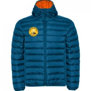
| Long Sleeve Jacket | |||
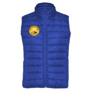
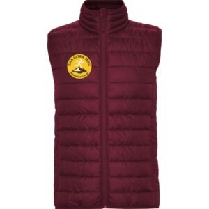
| Sleevless Jacket | |||
| head light | |||
| Cost | early bird until 31-Jan-2026: 100€ 01-Feb-2026-01-Mar-2026: 120€ | early bird until 31-Jan-2026: 50€/person 01-Feb-2026-01-Mar-2026: 70€/person | 30€ |
The fee will be paid electronically by card (debit or credit); no other payment methods will be accepted. Payment must be made immediately, otherwise the registration will be invalid. A confirmation email will be sent after payment.


REGISTRATIONS
– Registration Start: September 2025
– Registration Deadline: March 1, 2026
*Athletes who have registered and wish to withdraw their registration can cancel it. If the cancellation is made before 31/01/2026, the full amount minus bank fees will be refunded. If the cancellation is made between 01/02/2026 and 01/03/2026, 50% of the registration fee minus bank fees will be refunded. After 01/03/2026, no refunds will be made for cancellations.
REGISTRATION FORM:
Entries will be submitted electronically.
Payment of the participation fee:
The fee must be paid electronically by card (debit or credit); no other payment methods will be accepted. Payment must be made immediately upon registration, otherwise the registration will not be valid. A confirmation email will be sent after payment.
CONTACT PHONE NUMBERS:
Available in the afternoon
Christos Gouvalis: +30 694 691 8465
Georgia Spanou: +30 698 138 2085
Kostas Nikolopoulos: +30 698 768 2553
Nikos Tentomas: +30 693 612 5340
Email: apsdromeonevias@gmail.com
RACE CANCELLATION:
If the race is not permitted to take place on the scheduled date, a new date will be announced. All payments will remain valid for the new date. Participants who do not wish to compete on the new date may request a refund. Refunds will be issued minus banking fees retained by the bank as administrative charges.
MEDICAL EXAMINATION:
Three days before the race, participating runners will receive a health questionnaire via email to be completed online. Alternatively, they can present the necessary medical certificates at the race packet pickup.